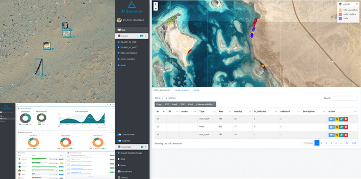
For a large semi-government organization, our team developed a system that detected litter objects from images captured by drones and helped to manage trash collection activities. We designed and developed a GIS-based application that allowed convenient interaction with detected litter objects and facilitated trash collection activities via optimal route planning and tracking of the collection progress.
This resulted in significant cost savings, halving the overall detection and collection costs. Furthermore, the collection time decreased by a factor of 4 while the automated computer vision solution allowed a 7% higher detection accuracy compared to a human expert. Additionally, this system decreased carbon footprint by a factor of 19.